

Radar and ILS Interference Studies in Airport Areas
Airports and their surroundings are constantly changing and growing. Urban development, construction of new buildings, infrastructure projects such as bridges, cranes and construction machinery can potentially create interference with air navigation systems, such as radars and instrument landing systems (ILS). These interferences pose significant risks to flight safety and require careful evaluation. In this paper, we examine the methodologies and processes used to study these interferences and the solutions to mitigate them.
Sommaire / Summary
Context and Necessity of Electromagnetic Impact Studies (EM)
Airport areas, due to their complex and ever-changing nature, require special attention to aviation safety. Construction projects near airports must be approved by civil aviation, represented by organizations such as the French Directorate General of Civil Aviation (DGAC). These organizations may require EM impact studies to assess the risk of disruptions to air navigation systems, including radars and ILS, on runways and approaches to aircraft.
Methodology for the Study of Radar Interference
1. 3D modeling of the building :
The first step is to create an accurate three-dimensional modeling of the building or obstacle in question. This modeling takes into account the dimensions, shape and materials of the obstacle.
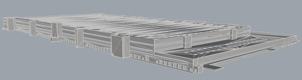
Building Modeling
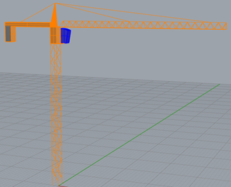
Crane modelling
2. Positioning in Georeferenced Landmark
The modeled building is then positioned in a georeferenced landmark relative to the radar. This makes it possible to accurately assess the distances and angles between the radar and the obstacle.
3. EM simulations :
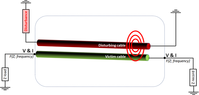
Electromagnetic simulations are performed. These simulations assess the risk of radar glare (undesirable reflections) as well as the risk of multipaths on runways and aircraft approach paths.
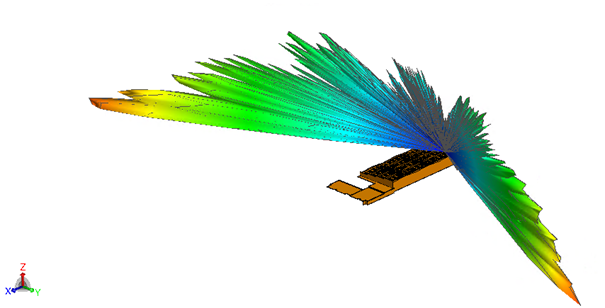
Radar electric field diffracted by a building.
4. Processing EM results:
Simulation results are analyzed using analytical formulas to assess the risk of false detections. We check whether transmitted or reflected signals exceed the thresholds of primary or secondary radars, which could mislead operators as a result of phantom echo generation.
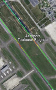
Electric field on the runways and approaches to Toulouse Blagnac airport generated by an obstacle
5. Recommendations for Risk Mitigation:
Based on the results obtained, recommendations are made concerning geometries, materials or locations to mitigate the risk of radar interference. These recommendations are designed to ensure flight safety and the reliability of air navigation systems.
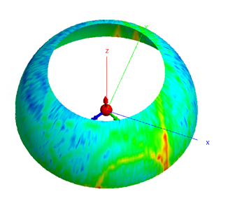
Orbits Results around the radar
ILS studies and Obstacle Impact Analysis
The ILS is an instrumental guidance system used by pilots to help them land in poor visibility conditions. Obstacles in the vicinity of runways can interfere with the signals emitted by ILS systems, compromising the accuracy of descent and runway centerline indications.
Atoll/Lagon, the software developed by the French Civil Aviation School (ENAC), is specially designed to assess the impact of obstacles on the DDM (Difference in Depth of Modulation) deviation of ILS systems. It is used to check whether systems maintain runway categorization constraints in accordance with ICAO standards, despite the presence of surrounding obstacles.
1. Building modeling :
The first step is to create an approximate but sufficient model of the building. This is represented by metal plates emulating the facades of the building to be constructed.
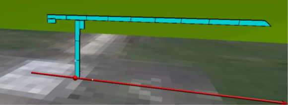
Crane modeling in Atoll
2. Positioning in the runway reference frame
The modelled building is then positioned in a geo-referenced reference frame in relation to the LOC or Glide, taking into account runway thresholds and ends, widths and key points.
3. EM PO simulations:
Electromagnetic simulations based on the PO ray-launching method are carried out. These simulations enable us to obtain an immediate result on the DDM and to conclude on the obstacle’s risk to the system.
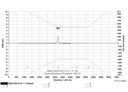
DDM ILS/LOC under Atoll in the presence of an obstacle
Conclusion
Radar and ILS interference studies are essential tools for ensuring impact assessment and optimizing construction projects in airport areas. By identifying and assessing risks at the earliest planning stages, these studies help avoid delays and costly complications, while guaranteeing the safety and efficiency of flight operations. By integrating these analyses into urban development processes, airport authorities and regulatory bodies help maintain high standards of safety and reliability in civil aviation.