NEXIO, CGX AERO and GEOMOD develop electromagnetic simulation software for airport environments
Through the MAXWELL project, the 3 French partner companies NEXIO, CGX AERO and GEOMOD are developing the EM4flight® software.
This high-performance electromagnetic simulation software solution enables antenna placement in airport environments, and performance analysis of radionavigation systems.
Begun in August 2019, this project will be completed in the first half of 2022.
EM4flight® is aimed at airport planning teams and manufacturers of radio navigation systems.
The main challenge of this project is to take into account the terrain relief over an area of more than 300 km around the antenna.
EM4flight® uses simulation to evaluate the performance of the following radionavigation systems:
- TACAN: Airborne radionavigation system operating in the UHF range.
- VOR: Radio positioning system used in air navigation and operating on VHF frequencies (or UHF for the military).
- NDB: Radio station located at an identified point and used as an aid to air or sea navigation.
- DME: Radio transponder used to determine the distance separating an aircraft from a ground station by measuring the time it takes a UHF (Ultra High Frequency) radio pulse to make a round trip.
- ILS: Radio navigation system used for precision approaches to aircraft under instrument flight rules.

NEXIO develops :
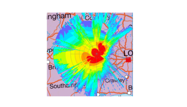
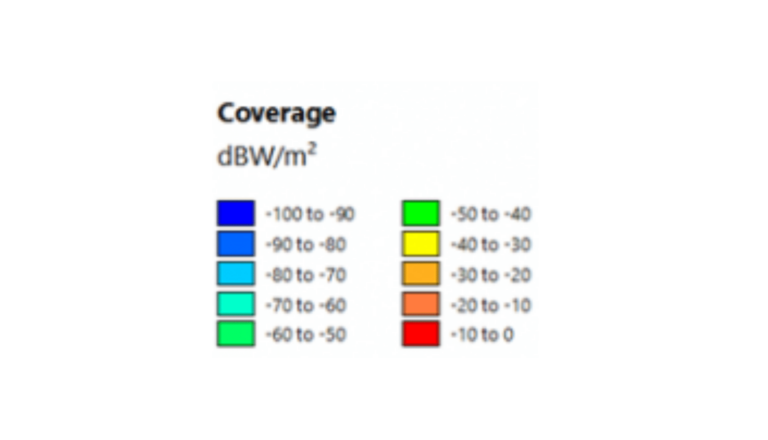
- for calculating antenna radio coverage,
- calculation of angle error (VOR, TACAN, NDB) and distance error (DME) on radial or orbital trajectories,
- to calculate the aircraft’s alignment error (ILS) on its approach path.
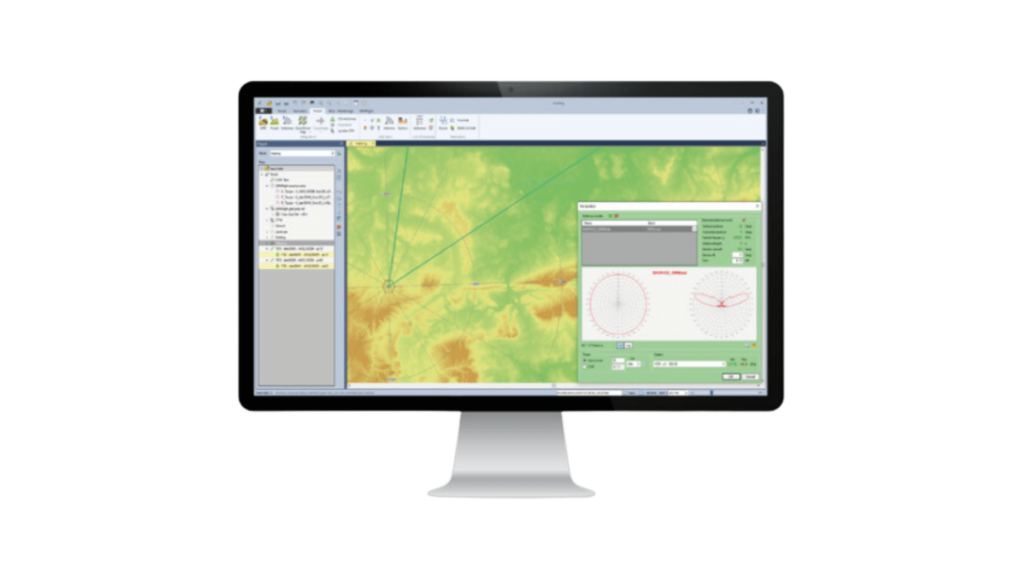
GEOMOD develops a graphical interface
coupled with a Geographic Information System (GIS) to model terrain, antennas and obstacles.
Each navigation system has its own interface and input parameters.
Electromagnetic propagation calculations are performed using algorithms based on beam launching.
A geometric engine determines all the 3D contributions of the antennas, and a physical engine calculates these contributions for each frequency band, taking into account the materials encountered.
Calculation results and coverage maps are then displayed in 2D and 3D modes.
The simulation software results were validated and compared with in-flight measurements.
CGX AERO manages project coordination
between one of the world’s leading manufacturers of radio navigation systems and experts in electromagnetism and GIS.
This coordination is reflected in the popularization of the operating principles of navigation equipment and the associated constraints.
Thanks to its expertise, CGX AERO and users have worked on optimizing working methods to optimize the deployment of CNS resources, based on a more systematic use of geographical data (DTM, obstacles, etc.) but also through the use of expert software to complement electromagnetic simulations.
The first version of EM4Flight® software is available and used by one of the world’s leading manufacturers of radio navigation systems.
Simulation results have been validated and compared with in-flight measurements.
EM4flight® is combined with CGX AERO’s Data4flight® software, which can be used to model an instrument flight path in 3D for simulation purposes and to optimize coverage performance.
The combination of three French companies, each specializing in its own field, provides a complete solution.
In addition to high-performance simulation software specifically designed for airport environments, the partners can provide customers with support in its use, as well as in the design and optimization of radionavigation systems.
ABOUT NEXIO
Founded in 2003, NEXIO is a pure player in the field of waves, with the ambition of transforming them into added value for manufacturers and users.
NEXIO offers the widest range of electromagnetic products and services on the market, and has established itself as a major player in the Aeronautics, Automotive, Space, Defense and Electronics sectors.
Today, NEXIO is the largest French engineering company dedicated to electromagnetism, with a team of over 80 technicians, engineers and PhDs, capable of handling all types of EMC, Lightning, RF, HYPER and RCS test, design and simulation problems.
With a long-term vision, NEXIO is pursuing a strategy of innovation and international development.
Its flagship BAT-EMC automation software (1995) is used by industry leaders and major testing laboratories.
Beyond technology and business, NEXIO men and women share values and a passion.
Their ambition?
To successfully complete projects with our customers and partners, in a spirit of teamwork and mutual respect, with a focus on performance and efficiency.
More information at https://nexiogroup.com/
ABOUT GEOMOD (Coexya group)
Geomod has been a publisher and distributor of land and marine geomatics software since 1995.
The company markets high value-added geomatic applications, and has been collaborating with the CSTB for twenty years on the development of MithraREM software for the electromagnetic field.
Geomod brings its expertise in the development and integration of geographic data, combining GIS technology with electromagnetic propagation solvers.
On November 30, 2021, Geomod will join the Coexya group, a Digital Services Company active in Consulting, Integration and Software Publishing.
Coexya operates in 6 areas of expertise: Customer Experience, Content & Modern Workplace, Health, Legal, Location intelligence and Smart data.
In 2020, the company generated sales of over 61.5 million euros and currently employs nearly 700 people based in Lyon, Paris, Brest and Rennes.
Further information at www.geomod.fr and www.coexya.eu
ABOUT CGX AERO
We’re passionate about what we do, and we want to share that passion with you.
Since 1996, CGX AERO has been designing and developing solutions to improve the native functionalities of the main geographic information systems, bringing them to
aeronautics.
CGX AERO is an independent company recognized today as a leading provider of business solutions and services, with a presence in over 55 countries, either directly or through appropriate partnerships.
Our range of services and products is in line with the dynamics of the global challenges facing air transport and touches on:Aeronautical and geographical data management, Aeronautical and geographical information systems, Instrument flight path design, Aeronautical cartography, Air transport, Sustainable development, Airport services (audit, compliance studies, strategic and prospective analyses…).
More information at www.cgx-group.com